Atmosphere

Atmospheric trends now includes outgoing long wave radiation (OLR) and anomaly plots (daily, weekly, monthly, seasonal); surface winds, sea level pressure (SLP); and global wind oscillation. Suggestions for additional plots are welcome.
Contents
    1. Daily Outgoing Long Wave Radiation (OLR) Plot
    2. Daily OLR Anomaly Plot
    3. Weekly Outgoing Long Wave Radiation (OLR) Plot
    4. Weekly OLR Anomaly Plot
    5. Monthly Outgoing Long Wave Radiation (OLR) Plot
    6. Monthly OLR Anomaly Plot
    7. Seasonal Outgoing Long Wave Radiation (OLR) Plot
    8. Seasonal OLR Anomaly Plot
    9. Animations
  1. Intra-seasonal Oscillations
    1. 5-Day Means 200-hPa Heights and Wind Speed
    2. 500-hPA Heights and Anomalies
    3. Time-Longitude Sections
      1. Equatorial
      2. 30-day 200-hPa Heights
      3. 30-day 500-hPa Heights
  2. Winds
    1. Surface Winds
    2. 250mb Winds
    3. Sea Level Pressure (SLP)
  3. 500mb Geopotential Heights
    1. 500mb Geopotential Heights 90-day Mean
  4. Global Wind Oscillation (GWO) Phase Plot

| Note: Missing graphics may be due to temporary server maintenance (or the occasional gov. shutdown). |


Daily Outgoing Long Wave Radiation (OLR) Plot
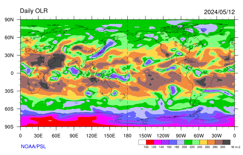
https://www.esrl.noaa.gov/psd/map/images/olr/olr.gif

Source: NOAA Earth System Research Laboratory

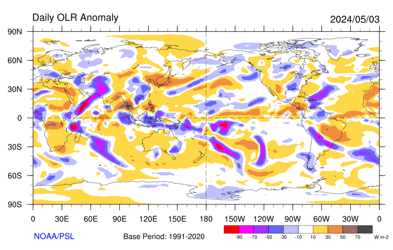
Daily OLR Anomaly Plot

https://www.esrl.noaa.gov/psd/map/images/olr/olr.anom.gif

Source: NOAA Earth System Research Laboratory

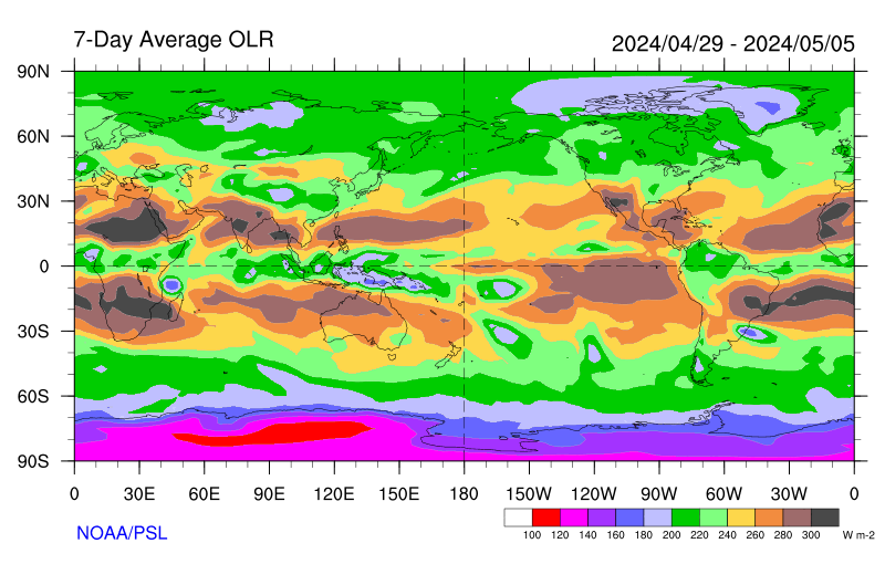
Weekly Outgoing Long Wave Radiation (OLR) Plot

https://www.esrl.noaa.gov/psd/map/images/olr/olr.7day.gif

Source: NOAA Earth System Research Laboratory

Weekly Loop

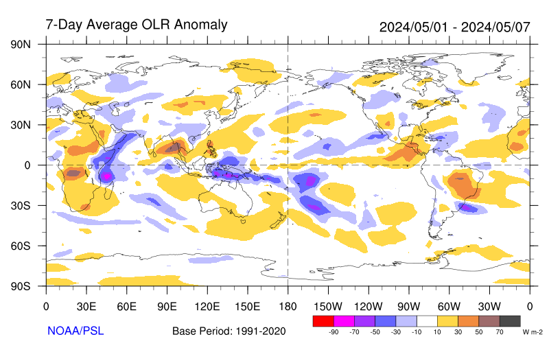
Weekly OLR Anomaly Plot

https://www.esrl.noaa.gov/psd/map/images/olr/olr.anom.7day.gif

Source: NOAA Earth System Research Laboratory

Weekly Loop

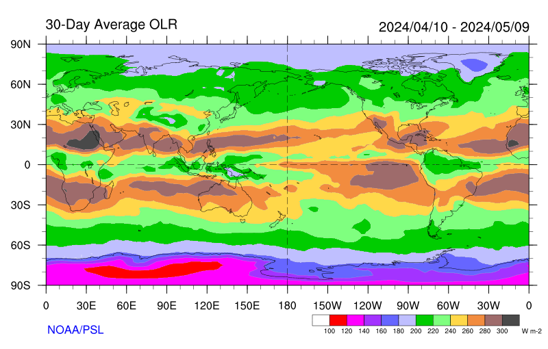
Monthly Outgoing Long Wave Radiation (OLR) Plot

https://www.esrl.noaa.gov/psd/map/images/olr/olr.30day.gif

Source: NOAA Earth System Research Laboratory

Monthly Loop

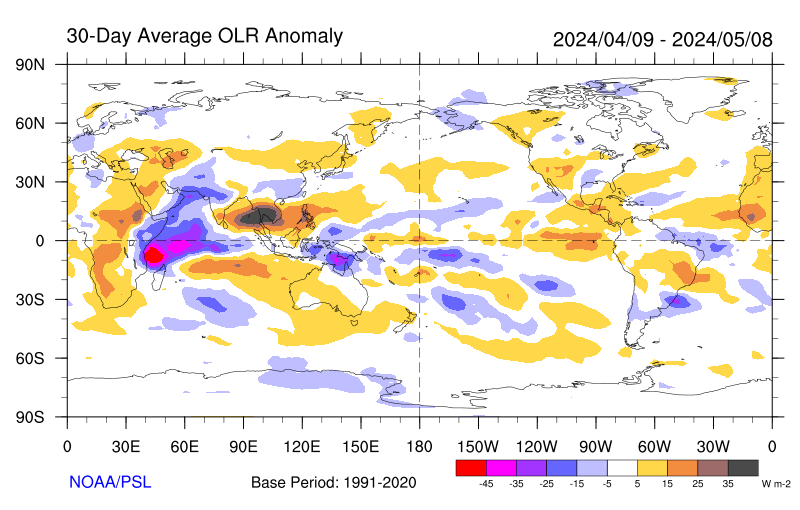
Monthly OLR Anomaly Plot

https://www.esrl.noaa.gov/psd/map/images/olr/olr.anom.30day.gif

Source: NOAA Earth System Research Laboratory

Monthly Loop

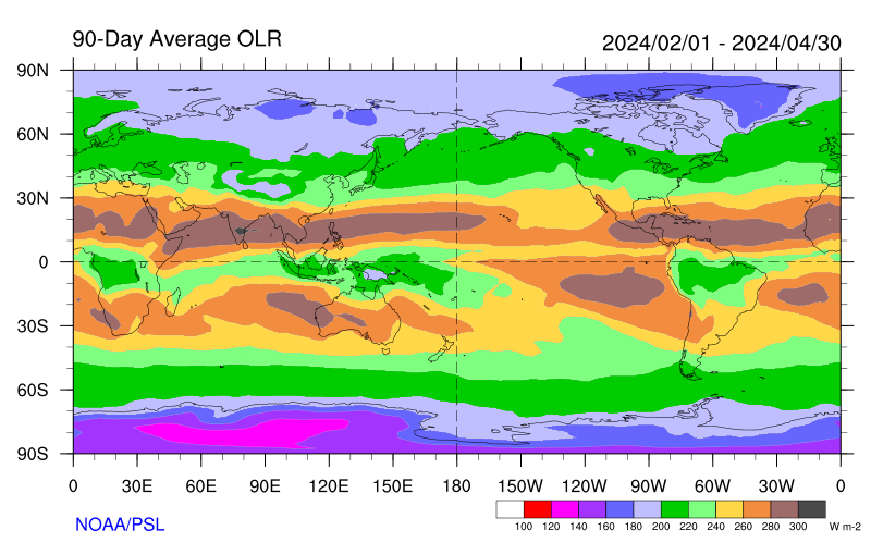
Seasonal Outgoing Long Wave Radiation (OLR) Plot

https://www.esrl.noaa.gov/psd/map/images/olr/olr.90day.gif

Source: NOAA Earth System Research Laboratory

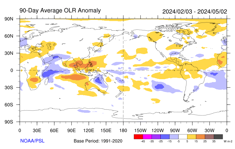
Seasonal OLR Anomaly Plot

https://www.esrl.noaa.gov/psd/map/images/olr/olr.anom.90day.gif

Source: NOAA Earth System Research Laboratory

Animations

Intra-seasonal Oscillations

5-Day Means 200-hPa Heights and Wind Speed


200 hecto Pascals Heights and Wind Speed

Source:


500-hPA Heights and Anomalies


500 hecto Pascals Heights and Anomalies

Source: https://www.cpc.ncep.noaa.gov/products/intraseasonal/

Time-Longitude Sections

Equatorial

Filtered OLR Anomalies (5°S-5°N)


Filtered Outgoing Long Wave Radiation 5 degrees south latitude to 5 degrees north latitude

Source: https://www.cpc.ncep.noaa.gov/products/intraseasonal/


200-hPa Velocity Potential (5°S-5°N)


200 hecto Pascals Velocity Potential Anomaly between 5 degrees south latitude and 5 degrees north latitude

Source: https://www.cpc.ncep.noaa.gov/products/intraseasonal/

850-hPa Zonal Wind Anomalies (5°S-5°N)


850 hecto Pascals Zonal Wind Anomalies 5 degrees south latitude to 5 degrees north latitude

Source: https://www.cpc.ncep.noaa.gov/products/intraseasonal/

30-day 200-hPa Heights


200 hecto Pascals height anomalies animation

Source: https://www.cpc.ncep.noaa.gov/products/intraseasonal/

30-day 500-hPa Heights

Northern Hemisphere


Northern Hemisphere 500 hecto Pascals height anomalies animation

Source: https://www.cpc.ncep.noaa.gov/products/intraseasonal/


Southern Hemisphere


Southern Hemisphere 500 hecto Pascals height anomalies animation

Source: https://www.cpc.ncep.noaa.gov/products/intraseasonal/

Mid-Latitude

High-Latitude

Winds

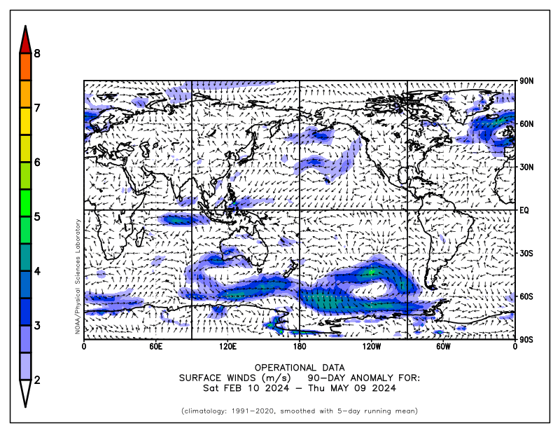
Surface Winds


fnl forecast model chart

Source: NOAA Earth System Research Laboratory

250mb Winds


fnl forecast model chart

Source: NOAA Earth System Research Laboratory

Sea Level Pressure (SLP)
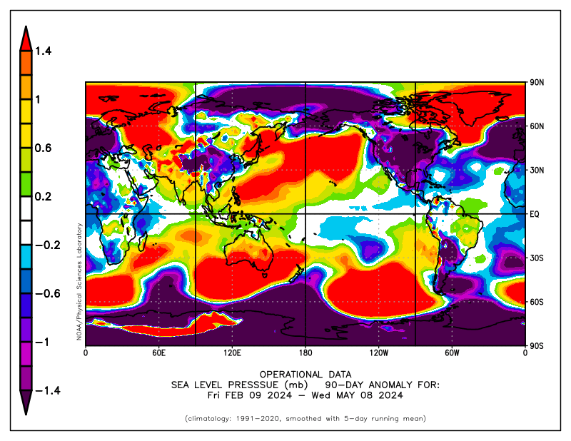
fnl forecast model chart

Source: NOAA Earth System Research Laboratory

500mb Geopotential Heights

500mb Geopotential Heights 90-day Mean
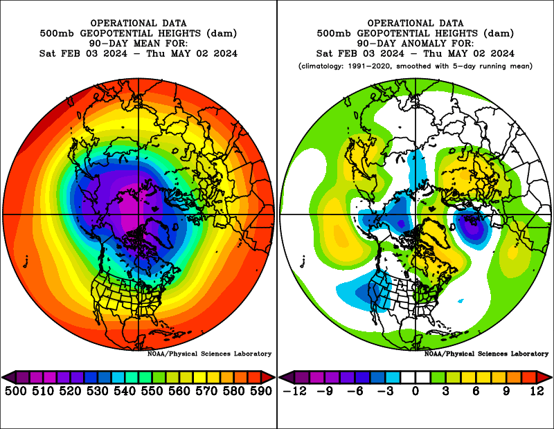
 

fnl forecast model chart

Source: NOAA/ESRL

Global Wind Oscillation (GWO) Phase Plot
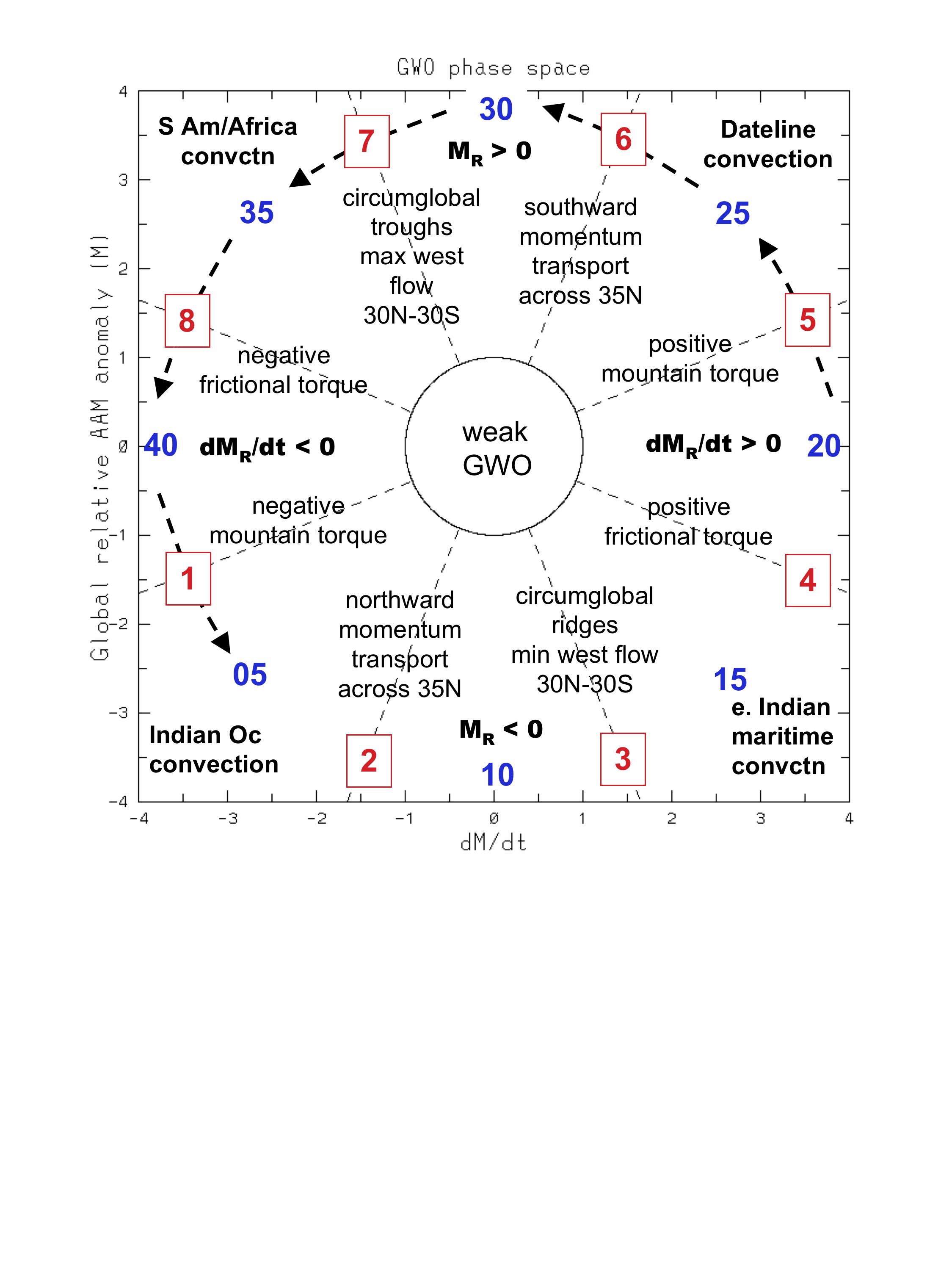


Source: https://www.esrl.noaa.gov/psd/map/clim/test_maproom.html

NOAA Earth System Research Laboratory